Contingency Planning
Careful planning is essential for any potential spill situation as incidents are far easier to resolve when a well prepared and tested contingency plan is available. Contingency plans provide the structure for the management and implementation of response operations. As such, they should be comprehensive, accessible and readily updateable, and reflect the working culture of the country within which they will be implemented.
In line with a best practice approach, the scope of a contingency plan should be based on what is known as a "tiered response" framework. This helps ensure that the planned response reflects the scale of the particular spill risk.
Spills that are small can often be dealt with locally (Tier 1). Should an incident prove beyond the local capability or affect a larger area, an enhanced but compatible response will be required (Tier 2). The foundation of this tiered response is the local plan for a specific facility, such as a port or oil terminal, or for a specific length of coastline at risk from a spill. These local plans may form part of a larger district or national plan (Tier 3). National plans may in turn be integrated into regional response arrangements covering two or more countries.
In general, contingency plans should follow a similar layout irrespective of whether they are local, national or regional in scope. This will enable the plans to be easily understood, assist compatibility and ensure a smooth transition from one tier level to the next.
The mere existence of a plan is not sufficient to ensure preparedness for responding to an oil spill. The planning process itself is as important: it serves to raise issues that will likely arise in a response and raises awareness on roles and responsibilities. Devising and compiling a contingency plan should follow a logical, four-step progression:
1. Risk Assessment:
Conducting a risk assessment as the first phase of the process ensures that plans are developed in the context of the risks they are intended to address. Essentially, this activity revolves around answering two questions:
- What is the likelihood of a spill occurring?
- What are the probable consequences if a spill does occur?
Areas where an oil spill is most likely to occur can be analysed using historical data that may often be readily available. Information on types, volumes and transport routes of oil as well as the location of past incidents can be used. Global statistics may be of use to highlight potential local concerns. For example, most spills occur in or close to ports, tend to be small in size and are often the result of bunkering or debunkering operations.
Once areas that have a high probability of a spill occurring have been identified, the magnitude of potential consequences can be estimated. This can be done by tracking likely movements of spilled oil (using metoceanic data), against the location of, and vulnerability to oil of sensitive resources.
2. Strategic Policy:
This section determines the response strategy to be applied in the event of a spill, and in particular whether the response is to be shipowner or government led as determined by national legislation. The geographic scope of the plan should be clear, as should the way the plan will fit in with others in the tiered response system.
Within the strategic policy, preferred response techniques and the allocation of equipment stockpiles should be determined. It is important that the rationale underpinning these decisions is clear at this stage as well. Preferred waste storage treatment and disposal streams are also one of the key operational factors to consider at this stage of the process.
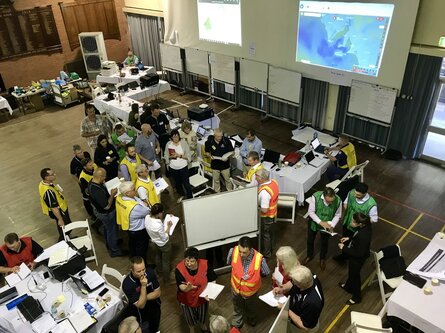
In any incident there are a number of functions that have to be fulfilled, usually by different entities. A key role of developing a strategic policy is to define overarching administrative and logistical procedures that will be initiated following an incident. Central to these will be those that concern the leadership, command and management of a response. Finally, the strategic policy should set out a timetable for training and exercises to maintain and improve preparedness.
3. Operational Procedures:
This section should define and develop the standard operating procedures to be followed in the event of a spill. There are six main components: Notification, Evaluation, Response, Clean-up, Communication, and Termination.
The information required to allow an accurate evaluation of an incident should be detailed, ie date, time, position, source, cause, amount and type of oil, slick size etc. and the procedure for evaluating the severity of the incident should be given. It is essential that a procedure for alerting response personnel and the relevant authorities should be included.
In summary, the plan should aim to facilitate the evaluation of the most appropriate response option according to the situation. Procedures should be included for establishing a dedicated response centre, for mobilising and deploying the necessary equipment and manpower, organising logistical support, coordinating aerial surveillance and considering any disposal options. In addition, guidelines for the level of clean-up required for each location should be provided together with procedures for standing down and reinstating equipment back into their respective stockpiles.
4. Information Directory:
This section of the plan is dedicated to the collation of all supporting data that may be required to implement a timely and effective response.
Useful information that should be contained in this section includes:
- Contact directory of response personnel - out of office contact details should be included where appropriate.
- Contact directory of third parties - those likely to have an interest in an incident, eg police, media, parties likely to be impacted, and other authorities.
- Primary response equipment - government, private contractor and oil industry equipment.
- Auxiliary response equipment - sources of workboats, tugs, helicopters, aircraft, barges, vacuum trucks, tractors, protective clothing, hand tools, radios etc.
- Logistics suppliers - suppliers of catering, housing, transport, sanitation, laundry etc.
- Manpower sources - contractors, local authorities, military, fire brigades, volunteer organisations and other sources.
- Experts and advisors - personnel with detailed knowledge of oil pollution, the local coastal environment (particularly of flora and fauna), safety, etc.
- Maps of sensitive areas - showing detailed information on the location of amenity and ecologically sensitive areas, seawater intakes, fisheries, mariculture, seabirds and marine mammals, and other resources likely to be threatened. Seasonal sensitivity should be highlighted.
- Maps of the coastal region - showing priorities for protection, illustrating strategies and restrictions, access points, waste sites, etc.
- Oil types likely to be encountered - detailing their properties, persistence, likely fate and effects, suitable response techniques, etc.